
A building entrance can be only a few meters from a bus stop and still be hard to reach. A driveway may cut across the direct walking route, a fence may force a detour, or the door may sit above street level with no accessible approach. These are architectural decisions as much as transport issues. Even on a single site, they determine whether the last part of a trip feels safe and continuous.
Urban mobility is often measured in routes, travel times and vehicle capacity. Architecture shapes the transition between public space and the places people use. Site layout, ground-floor planning, entrances, servicing and parking can support a connected street network or interrupt it. Owners and developers need to know which decisions sit within the project boundary, which require city coordination and which will still work after occupation. That does not mean treating every building as a transport project.
Start with journeys, not the site boundary
Follow people from nearby origins to the door they actually need. Map transit stops, crossings, cycle routes, accessible paths, parking, loading areas and neighboring destinations. The shortest line on a plan may be unusable once level changes, signal delays, missing crossings or poorly lit edges are taken into account.
Arrival patterns differ. A resident carrying groceries, a patient using a mobility aid, a courier and a child arriving at school may need different routes. That does not mean adding a separate doorway for every group. First, estimate demand and find where their movements intersect.
Evidence to collect before fixing the layout
- Existing conditions: pedestrian desire lines, pavement widths, gradients, crossing locations, curb access and known collision or near-miss points.
- Time patterns: peak arrivals, school or clinic schedules, delivery windows and evening use. A site that works at midday may struggle during a short morning peak.
- Network changes: approved street works, transit proposals and adjacent developments, with unfunded plans identified separately.
- Operational needs: waste collection, emergency access, maintenance, accessible drop-off and the turning requirements of vehicles that must enter the site.
Observe the street, too; drawings and traffic counts will not show everything. A repeated informal crossing may reveal a route people need even though no formal crossing exists. The response could require discussion with the highway authority rather than a site-only change, but the evidence should still inform where the building opens to the street.
Make walking routes direct and legible
A walkable site provides a continuous route between the public footway and its main entrances without sending people through parking aisles or across loading aprons. On a larger block, a publicly accessible passage may shorten trips between streets. It is useful only if people can find it, use it when needed and rely on it being maintained as a route rather than leftover space.
Put entrances on the routes people actually use. An attractive frontage does little for access if the main door is around the corner, adding distance and encouraging shortcuts. Transparent ground-floor uses can help with orientation, but people still need clear signs, suitable lighting and an obvious route to the door.
Set route width against expected flows and how the space will be shared, not as an isolated figure. Passing space matters more when someone uses a wheelchair, walks beside a companion or waits near an entrance. Columns, planters, outdoor seating and open doors reduce the clear width available. Accessibility and public-realm standards provide the baseline; predictable crowding may call for more space.
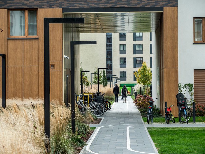
Design crossings as part of the arrival sequence
Where a walking route crosses a vehicle entrance, make the conflict visible and easy to understand. Keep the crossing as narrow as practical, preserve sightlines around walls and planting, and avoid gates that leave waiting cars blocking the footway. The design must meet local street rules and the requirements of the authority controlling the access. A prominent surface treatment cannot make up for poor visibility or excessive vehicle speed.
On complex sites, trace the full trip across the plan at walking pace: transit stop, crossing, footway, driveway and correct lobby. Note every level change and point where someone has to choose a direction. This can reveal gaps that a vehicle-focused access drawing misses.
Accessibility is a route requirement, not a door feature
An accessible entrance is of limited use if the approach depends on a steep path, a blocked dropped curb or a lift that closes outside office hours. Assess the route from transit, accessible parking and drop-off to the principal functions as one continuous chain. Depending on the project and jurisdiction, that means checking gradients, landings, crossfalls, tactile information, door maneuvering space and signage. Local codes govern dimensions, but the design team must also check how those requirements work together on the site.
Resolve level changes early in massing. A ground floor set substantially above the footway may demand long ramps or squeeze entrances into limited frontage. Adjusting floor levels, moving the main door or redesigning the landscape may be better than forcing an accessible path into a narrow strip. If an external lift is essential to the route, its opening hours, weather protection, maintenance access and outage arrangements matter too.
People also need to know where to go. A first-time visitor to a medical or civic building should be able to identify the right entrance before reaching a confusing junction. Consistent names, readable signs, lighting and views to reception reduce backtracking, including for people with sensory or cognitive impairments and visitors under time pressure.
Plan around transit, cycling and short trips
An architect cannot set a bus timetable, but can keep the route to the stop short and unobstructed. An entrance near an existing transit route may serve people better than one facing a prominent vehicle forecourt. On multi-building sites, active shared uses can line the path to transit without routing every trip through a private lobby.
Cycling needs a practical route from street to storage and back. A store hidden behind a loading bay or reached by a narrow stair is less useful than one with a clear approach, manageable doors and room to maneuver. Check where riders enter, cross pedestrian paths and park. Where demand warrants it, allow for different bicycle sizes; distinguish secure long-stay storage from short-stay visitor spaces near entrances. Local standards may set the number of spaces, but a compliant count says little about everyday usability.
Micromobility parking must leave the pedestrian route clear. If shared devices are expected, identify a suitable area and coordinate with local operators or the authority as needed. Building management may also need a way to deal with displaced devices. Paint alone will not keep them in place.
Keep servicing from controlling the public edge
Deliveries, waste collection and maintenance are essential, but their access can overwhelm a frontage if it is oversized or poorly placed. Base early vehicle tracking on the largest vehicle genuinely needed for regular operations, rather than assuming the biggest possible truck must reach every door. Occasional larger deliveries may be better handled through a managed procedure than a permanently wider access. Fire, highway and operational requirements must be checked before making that choice.
Separate loading from main pedestrian arrivals where possible. If routes must cross, assess reversing, waiting space and when the busiest movements overlap. A service gate beside a school entrance poses a different risk during morning arrival than later in the day. In a mixed-use building, residential access may need to remain clear during retail deliveries. Agree operating hours alongside the physical layout; a servicing plan that depends on perfect behavior every day is unlikely to hold up.
Parking can affect the street beyond the property line. A queue at a garage barrier may block a cycle track or bus lane, even if vehicles usually wait on private land. Test entry processing time, space for waiting cars and what happens when the facility is full. Moving the barrier inward, changing access control or reconsidering the number and position of entrances may address the problem.
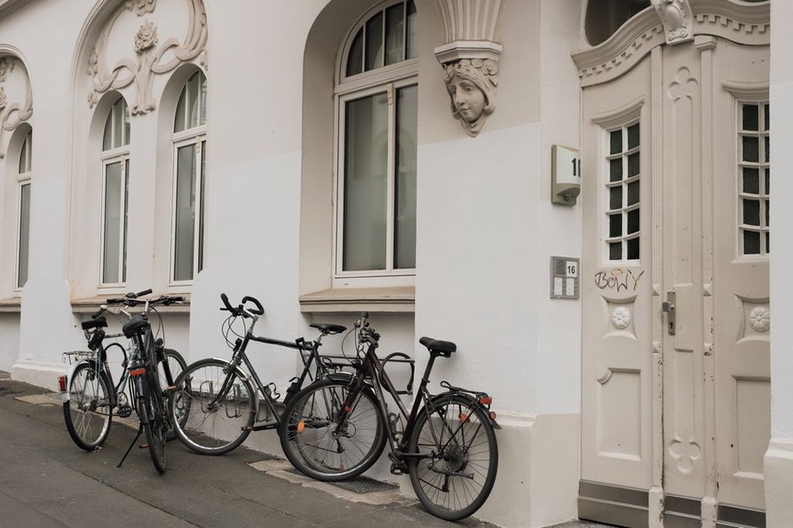
Use the ground floor to support public movement
Ground-floor design can make a route comfortable to use without turning a private site into an unmanaged public space. Doors, windows and occupied rooms facing a path provide passive oversight; blank walls and deep recesses can make the same path less inviting after dark. Entrance weather protection helps people waiting for pickups or assisting someone through a door, provided canopies and columns do not narrow the footway or conflict with trees and utilities.
Coordinate seating, planting and signs so they offer places to pause and cues for orientation without turning the approach into an obstacle course. The relationship between placement and upkeep is explored in urban furniture placement and maintenance in public space. On a project, establish who owns each element, who repairs it and whether it can remain usable without blocking movement.
Shortcuts through a development need explicit management. Their value may depend on opening hours, lighting and a legal access arrangement. If security calls for a gate, show its likely closure times during planning rather than leaving residents to discover them later. A connection closed for much of the day should not be counted as an unrestricted link in a mobility assessment.
Test trade-offs before approvals lock them in
Mobility improvements compete for frontage and ground-floor area. A wider pavement may leave less room for planting or drop-off. One vehicle access can keep the footway more continuous but lengthen travel within the site. Additional entrances may shorten walks while adding staffing, security and maintenance costs. Quantify these trade-offs rather than favoring one mode by default.
For larger or sensitive projects, compare options using a focused set of measures: walking distance to key entrances, vehicle-pedestrian conflict points, route gradients, peak crowding, continuity of accessible routes and space for servicing. Choose measures that reflect local demand and test them at the busiest relevant times. A transport consultant may model effects beyond the site; the architect needs to bring those findings back into the plan.
Speak early with those who control the adjoining network. Highway authorities may need to approve crossings, access positions or footway changes, while transit agencies may have requirements near stops. Fire access, planning conditions, land ownership and accessibility rules can constrain an otherwise promising layout. Approval of a site plan does not itself authorize changes to the public street; work beyond the boundary may need separate funding and delivery agreements.
In the cost plan, distinguish essential route works from improvements that can be phased. A clear accessible approach and safe vehicle crossing are harder to retrofit than secondary seating. Record intended access hours, service vehicle assumptions and maintenance responsibilities in the project brief so cost reductions do not undermine the mobility strategy.
Check performance after occupation
Compliance on drawings is only the starting point. Once the building opens, observe where people walk, where bicycles accumulate, whether deliveries wait in the intended place and whether entrance queues spill onto the pavement. Ask facilities staff as well as users: cleaning equipment, waste collection and short-term deliveries often cause recurring obstructions that geometry alone did not predict.
Evidence may point to a small fix: move a sign to prevent wrong turns, shift a bicycle rack to restore passing space, or change a delivery window to avoid peak arrivals. A barrier too close to the street is harder to remedy. Before that position is fixed, draw at least one representative peak-hour scenario with a pedestrian approaching the main entrance, a delivery vehicle entering and an accessible drop-off in use. If all three cannot fit safely on the plan, relying on them to coexist at the curb is a poor bet.